

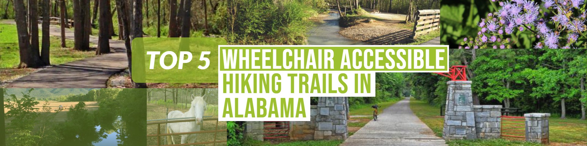
Chief Ladiga Trail
In northeast Alabama, the 33-mile Chief Ladiga Trail is a regional playground that passes through welcoming towns and pastoral landscapes. Following a former CSX railroad corridor, the rail-trail is named for the Creek Indian leader who signed the 1832 Cusseta Treaty, surrendering the tribe's remaining land in the area.
Remarkably flat and smooth, the trail arcs from Woodland Park in Anniston northeast through small towns and quiet countryside to the state line with Georgia, where it connects to the Silver Comet rail-trail. It begins on a slightly raised rail bed before entering open fields, passing beneath canopies of pine, dogwood and other native trees and alongside enchanting wetlands. You'll find numerous access points along the way.
{Read More & View Photos Here}


Aldridge Creek Greenway
This paved greenway trail is well maintained and follows Aldridge Creek, running parallel to Bailey Cove Road, from Mountain Gap Road to Green Cove Road. There are proposals to extend the greenway north of Mountain Gap Road. Rabbits, turtles and various other wildlife can be seen on the trail, and it's popular for birdwatchers. The trail passes under all main roads, making it safe at crossings.
Parking and Trail Access
From Huntsville, turn onto Hobbs Island Road off Hwy 231(Memorial Parkway, South Huntsville); it's the last road before the Tennessee River Bridge. Take the first right onto Ditto Landing Road SE. You can park at any of the public parking in Ditto Landing, but be aware that it closes at sundown. Parking is also available at Ken Johnston Park in Huntsville
{Read More & View Photos Here}


Horse Creek Trail
The Horse Creek Trail spans just over 3 paved miles between Dora and Sumiton, two small communities northwest of Birmingham. As the trail was built on a former railroad bed, it's a flat, easy walk or bike ride. It follows the route of the Kansas City, Memphis, and Birmingham Railroad, which came here in 1886.
The trail begins across the street from Dora's T.S. Boyd Elementary School and is soon lined by trees to either side. Along the way, it passes by residential neighborhoods and the Horse Creek Golf Course. From the trail's end at Highway 78, travelers can connect to the short, paved Sumiton Trail, which leads into the city, ending at Sumiton's City Hall on College Street.
Parking and Trail Access
Parking is available at T.S. Boyd Elementary School (23 Austin Circle Drive) and near the Horse Creek Golf Course (1745 Hwy 78, off of Corridor X). Parking is also available near the intersection of Bryan Cutoff Road and Crest Drive and where Sellars Road crosses the trail.
{Read More & View Photos Here}


Yoholo Micco Trail
Nature-lovers, birdwatchers and history buffs will enjoy the many hidden gems this trail has to offer, including a waterfall (hidden off of side trail), nesting bald eagles, an old cemetery (another side trail) and a wall built more than 100 years ago. The trail—formerly known as the Eufaula Rail-Trail—boasts splendid views of Lake Eufaula.
Phase 2 of the trail was completed in 2010 and includes a path over the old trestle across the lake, heading north to Old Creek Town, the former site of a Creek Indian village. The trail begins in downtown Eufaula, in front of the Eufaula/Barbour County Chamber of Commerce.
Parking and Trail Access
Parking is available at the Chamber of Commerce, 333 E. Broad St., and at the Old Creek Town Recreation Area on Lake Drive.
{Read More & View Photos Here}


Vulcan Trail
Birmingham's mile-long Vulcan Trail scales the ridge of 1,025-foot Red Mountain. In summer, the tree-lined trail offers cool respite from the heat, while bare winter trees yield city views. Best of all, it takes little effort to enjoy this breathtaking scenery; like most rail-trails, the route is flat.
The paved surface is especially inviting for walkers, joggers and those taking pets for a stroll.
From the parking area, the path traces the route of the former L&N Birmingham Mineral Railroad. (With roots as a steel town, Birmingham is one of the few geologic zones where one can find all three mineral components—iron ore, coal, and limestone—needed to make steel.)
The trail offers a bird's-eye view of many notable historic structures and areas, including the Arlington Antebellum Home and the Birmingham Civil Rights District, a six-block tribute to the civil rights movement that contains the Alabama Jazz Hall of Fame and the Sixteenth Street Baptist Church, site of an infamous 1963 Ku Klux Klan bombing that killed four young black girls.
The route runs below 10-acre Vulcan Park, home to the world's largest cast-iron statue and trail/park namesake. An Italian sculptor crafted the 56-foot statue of Vulcan, the Roman god of fire, for the 1904 World's Fair in St. Louis to showcase Birmingham's burgeoning industrial might. The park also houses the Vulcan Center, which traces the city's industrial past and offers rotating exhibits. While the park remains inaccessible from the trail, plans call for that to change.
Parking and Trail Access
Directions: From I-65, take Exit 256-A/Oxmoor Road and drive east about a mile toward Homewood; Oxmoor becomes Palisades Boulevard. Turn right on Valley Avenue, drive 1.6 miles, then turn left on Richard Arrington Jr. Boulevard. The trailhead is 0.2 mile down on the left.
Contact:
Vulcan Trail Association
P.O. Box 382754
Birmingham, AL 35238-2754
Vulcan Park Foundation
1701 Valley View Drive
Birmingham, AL 35209
(205) 933-1409
{Read More & View Photos Here}


For a full list of trails head on over to TrailLink
